Geolocate

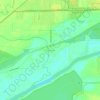
Morris topographic map

Click on the map to display elevation.

Morris

Morris is located in northeast Grundy County along U.S. Route 6 and Illinois Route 47 and on the north side of the Illinois River at an elevation of 515 feet (157 m).

Wikipedia (CC-BY-SA 3.0)

About this map

Name: Morris topographic map, elevation, terrain.

Location: Morris, Grundy County, Illinois, 60450, United States (41.34992 -88.49011 41.40865 -88.37997)

Average elevation: 531 ft

Minimum elevation: 482 ft

Maximum elevation: 587 ft

Grundy County trails, hiking, mountain biking, running and outdoor activities

Other topographic maps

Click on a map to view its topography, its elevation and its terrain.
Aux Sable

United States > Illinois > Grundy County

Average elevation: 512 ft

Pebble Beach

United States > Illinois > Grundy County

Average elevation: 522 ft

Gear up for your next adventure:

🥩Freeze-Dried Meals - Nutritious and lightweight food for remote expeditions
🚁Photography Drones - Capture stunning aerial views of landforms and topography
😴Insulated Sleeping Pads - Compact and warm pads for high-elevation camping
📡GPS Antenna Upgrade - Enhance GPS reception in remote terrain
🎒Trail Energy Bars - High‑calorie bars for hiking energy

As an Amazon Associate, this site earns from qualifying purchases at no extra cost to you.