
Gurro topographic map
Interactive map
Click on the map to display elevation.
About this map
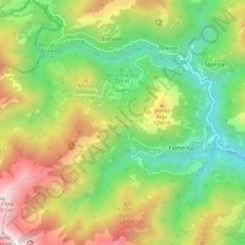
Name: Gurro topographic map, elevation, terrain.
Location: Gurro, Verbano-Cusio-Ossola, Piemont, 28828, Italien (46.06013 8.51124 46.09591 8.59344)
Average elevation: 3,248 ft
Minimum elevation: 1,260 ft
Maximum elevation: 6,257 ft