
Schwanebeck topographic map
Interactive map
Click on the map to display elevation.
About this map
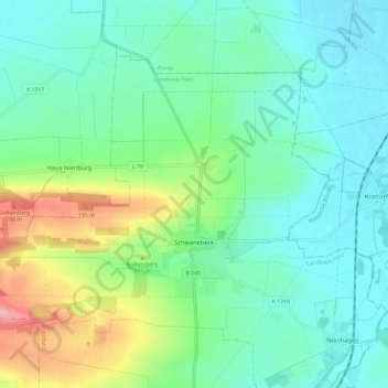
Name: Schwanebeck topographic map, elevation, terrain.
Location: Schwanebeck, Vorharz, Landkreis Harz, Saxony-Anhalt, Germany (51.95181 11.04470 52.00344 11.16227)
Average elevation: 384 ft
Minimum elevation: 259 ft
Maximum elevation: 745 ft