
Niederahr topographic map
Interactive map
Click on the map to display elevation.
About this map
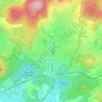
Name: Niederahr topographic map, elevation, terrain.
Location: Niederahr, Wallmerod, Westerwaldkreis, Rijnland-Palts, Duitsland (50.47833 7.84172 50.51252 7.88335)
Average elevation: 1,125 ft
Minimum elevation: 837 ft
Maximum elevation: 1,565 ft