
Beaurain topographic map
Interactive map
Click on the map to display elevation.
About this map
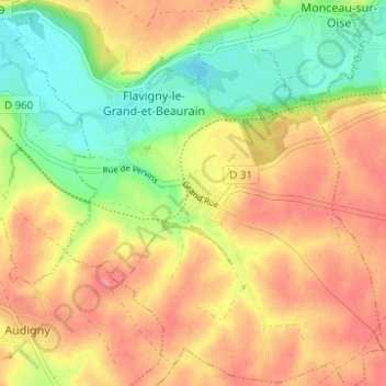
Name: Beaurain topographic map, elevation, terrain.
Average elevation: 440 ft
Minimum elevation: 308 ft
Maximum elevation: 545 ft
Other topographic maps
Click on a map to view its topography, its elevation and its terrain.
Flavigny-le-Grand
France > Hauts-de-France > Aisne > Flavigny-le-Grand-et-Beaurain > Flavigny-le-Grand
Flavigny-le-Grand, Flavigny-le-Grand-et-Beaurain, Vervins, Aisne, Hauts-de-France, France métropolitaine, 02120, France
Average elevation: 433 ft