
Introd topographic map
Interactive map
Click on the map to display elevation.
About this map
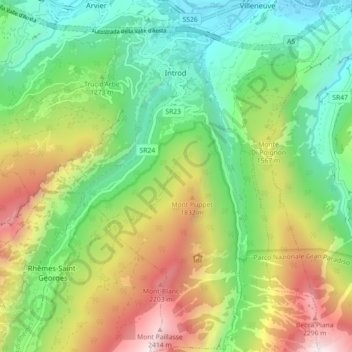
Name: Introd topographic map, elevation, terrain.
Location: Introd, Valle d'Aosta, Italia (45.64085 7.12242 45.70321 7.21125)
Average elevation: 4,354 ft
Minimum elevation: 2,083 ft
Maximum elevation: 8,274 ft