
Hempstead topographic map
Click on the map to display elevation.
About this map
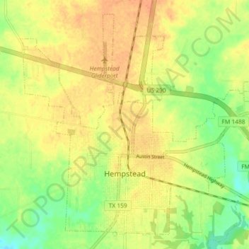
Name: Hempstead topographic map, elevation, terrain.
Location: Hempstead, Waller County, Texas, 77445, United States (30.07734 -96.11137 30.13323 -96.03870)
Average elevation: 226 ft
Minimum elevation: 154 ft
Maximum elevation: 276 ft
Waller County trails, hiking, mountain biking, running and outdoor activities
Other topographic maps
Click on a map to view its topography, its elevation and its terrain.