
Botley topographic map
Click on the map to display elevation.
About this map
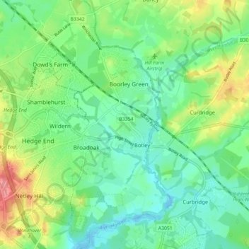
Name: Botley topographic map, elevation, terrain.
Location: Botley, Eastleigh, Hampshire, England, United Kingdom (50.89132 -1.30342 50.94685 -1.25990)
Average elevation: 85 ft
Minimum elevation: -16 ft
Maximum elevation: 259 ft
Other topographic maps
Click on a map to view its topography, its elevation and its terrain.