
Arabba topographic map
Interactive map
Click on the map to display elevation.
About this map
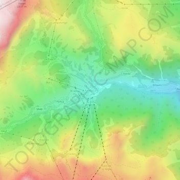
Name: Arabba topographic map, elevation, terrain.
Location: Arabba, Livinallongo del Col di Lana, Belluno, Veneto, Italy (46.47735 11.85534 46.51735 11.89534)
Average elevation: 6,335 ft
Minimum elevation: 4,724 ft
Maximum elevation: 8,333 ft