
Thank you for supporting this site ❤️
Make a donation
Make a donation
Gear up for your next adventure:
As an Amazon Associate, this site earns from qualifying purchases at no extra cost to you.
地图 topographic map
Click on the map to display elevation.
Thank you for supporting this site ❤️
Make a donation
Make a donation
Gear up for your next adventure:
As an Amazon Associate, this site earns from qualifying purchases at no extra cost to you.
About this map
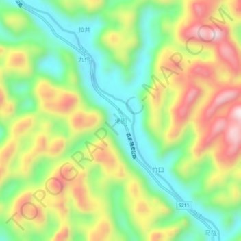
Name: 地图 topographic map, elevation, terrain.
Location: 地图, 都安瑶族自治县, 河池市, 广西壮族自治区, 中国 (24.22079 108.29065 24.26079 108.33065)
Average elevation: 1,135 ft
Minimum elevation: 325 ft
Maximum elevation: 2,215 ft
Thank you for supporting this site ❤️
Make a donation
Make a donation
Gear up for your next adventure:
As an Amazon Associate, this site earns from qualifying purchases at no extra cost to you.
Other topographic maps
Click on a map to view its topography, its elevation and its terrain.