
Voluntown topographic map
Interactive map
Click on the map to display elevation.
About this map
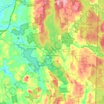
Name: Voluntown topographic map, elevation, terrain.
Average elevation: 335 ft
Minimum elevation: 108 ft
Maximum elevation: 636 ft
Other topographic maps
Click on a map to view its topography, its elevation and its terrain.
Moosup
United States > Connecticut > Northeastern Connecticut COG > Plainfield > Moosup
Moosup, Plainfield, Northeastern Connecticut COG, Connecticut, 06354, United States
Average elevation: 305 ft