
Djidian Kéniéba topographic map
Interactive map
Click on the map to display elevation.
About this map
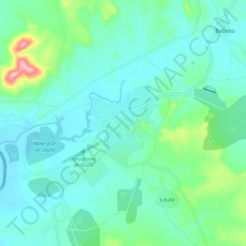
Name: Djidian Kéniéba topographic map, elevation, terrain.
Location: Djidian Kéniéba, Kéniéba, Kayes, Mali (13.05433 -11.42573 13.13433 -11.34573)
Average elevation: 410 ft
Minimum elevation: 299 ft
Maximum elevation: 896 ft
Other topographic maps
Click on a map to view its topography, its elevation and its terrain.