
Aa topographic map
Interactive map
Click on the map to display elevation.
About this map
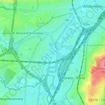
Name: Aa topographic map, elevation, terrain.
Location: Aa, Anderlecht, Bruxelles-Capitale, 1070, Belgique (50.80142 4.28540 50.84142 4.32540)
Average elevation: 115 ft
Minimum elevation: 49 ft
Maximum elevation: 351 ft
Other topographic maps
Click on a map to view its topography, its elevation and its terrain.
Moortebeek
Belgique > Bruxelles-Capitale > Anderlecht
Moortebeek, Anderlecht, Bruxelles-Capitale, 1070, Belgique
Average elevation: 157 ft