
El Cóporo topographic map
Interactive map
Click on the map to display elevation.
About this map
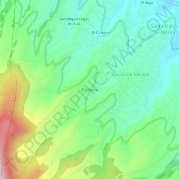
Name: El Cóporo topographic map, elevation, terrain.
Average elevation: 9,954 ft
Minimum elevation: 9,252 ft
Maximum elevation: 11,509 ft
Other topographic maps
Click on a map to view its topography, its elevation and its terrain.
El Curtidor
México > Estado de México > Zinacantepec > Barrio De México
El Curtidor, Barrio De México, Zinacantepec, Estado de México, 51360, México
Average elevation: 9,665 ft