
La Tania topographic map
Interactive map
Click on the map to display elevation.
About this map
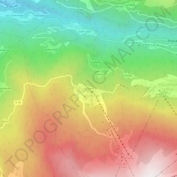
Name: La Tania topographic map, elevation, terrain.
Average elevation: 4,344 ft
Minimum elevation: 1,906 ft
Maximum elevation: 7,047 ft
Other topographic maps
Click on a map to view its topography, its elevation and its terrain.
Col du Rateau
France > Auvergne-Rhône-Alpes > Savoie > Courchevel
Col du Rateau, Saint-Bon-Tarentaise, Courchevel, Albertville, Savoie, Auvergne-Rhône-Alpes, France métropolitaine, 73120, France
Average elevation: 8,176 ft