
Ferreiros topographic map
Interactive map
Click on the map to display elevation.
About this map
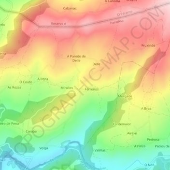
Name: Ferreiros topographic map, elevation, terrain.
Location: Ferreiros, Paradela, Sarria, Lugo, Galiza, Espanha (42.76806 -7.54862 42.80050 -7.50701)
Average elevation: 2,149 ft
Minimum elevation: 1,614 ft
Maximum elevation: 2,644 ft
Other topographic maps
Click on a map to view its topography, its elevation and its terrain.