Geolocate

Cristelo topographic map

Click on the map to display elevation.

About this map

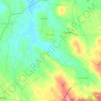
Name: Cristelo topographic map, elevation, terrain.

Location: Cristelo, Barcelos, Braga, Portugal (41.45431 -8.72068 41.49118 -8.68259)

Average elevation: 135 ft

Minimum elevation: 0 ft

Maximum elevation: 351 ft

Other topographic maps

Click on a map to view its topography, its elevation and its terrain.

Franqueira

Portugal > Braga > Barcelos

Average elevation: 479 ft

Gear up for your next adventure:

🧦Merino Wool Socks - Moisture-wicking, blister-preventing socks for long treks
🧢Outdoor Hiking Hat - Sun protection hat for outdoor explorers
🔪Outdoor Multitools - Essential survival tools for gear repair and field use
🪑Ultralight Camp Chairs - Portable seating for resting after a long day of mapping
🔌Solar Panel Charger - Charge gear sustainably outdoors

As an Amazon Associate, this site earns from qualifying purchases at no extra cost to you.