
ວັງວຽງ topographic map
Interactive map
Click on the map to display elevation.
About this map
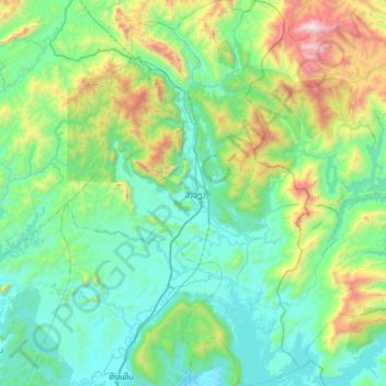
Name: ວັງວຽງ topographic map, elevation, terrain.
Location: ວັງວຽງ, Provinz Vientiane, Laos (18.62624 102.24038 19.21643 102.63170)
Average elevation: 2,008 ft
Minimum elevation: 581 ft
Maximum elevation: 7,917 ft
Other topographic maps
Click on a map to view its topography, its elevation and its terrain.
ນາຕີ້ວ
Laos > Provinz Vientiane > Feuang
ນາຕີ້ວ, Feuang, Provinz Vientiane, Laos
Average elevation: 955 ft