
Tella topographic map
Interactive map
Click on the map to display elevation.
About this map
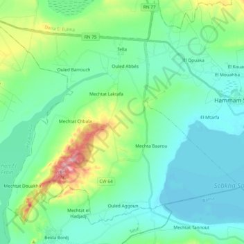
Name: Tella topographic map, elevation, terrain.
Location: Tella, Hammam Sokhna District, Setif, Algeria (35.89954 5.62264 36.02650 5.80965)
Average elevation: 2,989 ft
Minimum elevation: 2,861 ft
Maximum elevation: 3,455 ft