
Chiara topographic map
Interactive map
Click on the map to display elevation.
About this map
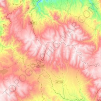
Name: Chiara topographic map, elevation, terrain.
Location: Chiara, Provincia de Huamanga, Ayacucho, 066, Perú (-13.53848 -74.29555 -13.20087 -74.04630)
Average elevation: 12,260 ft
Minimum elevation: 9,121 ft
Maximum elevation: 14,196 ft
Other topographic maps
Click on a map to view its topography, its elevation and its terrain.
Huanu Huanu
Perú > Ayacucho > Chiara > Huanu Huanu
Huanu Huanu, Chiara, Provincia de Huamanga, Ayacucho, 066, Perú
Average elevation: 11,027 ft