
Thank you for supporting this site ❤️
Make a donation
Make a donation
Gear up for your next adventure:
As an Amazon Associate, this site earns from qualifying purchases at no extra cost to you.
Balazar topographic map
Click on the map to display elevation.
Thank you for supporting this site ❤️
Make a donation
Make a donation
Gear up for your next adventure:
As an Amazon Associate, this site earns from qualifying purchases at no extra cost to you.
About this map
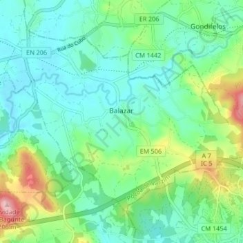
Name: Balazar topographic map, elevation, terrain.
Location: Balazar, Póvoa de Varzim, Porto, Portugal (41.38274 -8.65643 41.41940 -8.59065)
Average elevation: 262 ft
Minimum elevation: 115 ft
Maximum elevation: 673 ft
Thank you for supporting this site ❤️
Make a donation
Make a donation
Gear up for your next adventure:
As an Amazon Associate, this site earns from qualifying purchases at no extra cost to you.