
Mantua topographic map
Interactive map
Click on the map to display elevation.
About this map
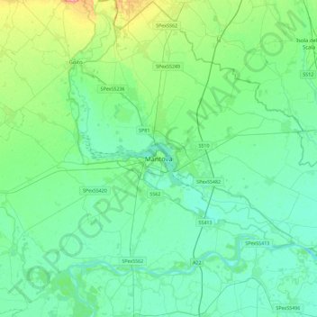
Name: Mantua topographic map, elevation, terrain.
Location: Mantua, Lombardy, 46100, Italy (44.99667 10.63172 45.31667 10.95172)
Average elevation: 89 ft
Minimum elevation: 26 ft
Maximum elevation: 341 ft
Other topographic maps
Click on a map to view its topography, its elevation and its terrain.