Geolocate

Maltby topographic map

Click on the map to display elevation.

About this map

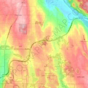
Name: Maltby topographic map, elevation, terrain.

Location: Maltby, Snohomish County, Washington, United States (47.77568 -122.17316 47.84296 -122.04330)

Average elevation: 377 ft

Minimum elevation: 3 ft

Maximum elevation: 712 ft

Snohomish County trails, hiking, mountain biking, running and outdoor activities

Gear up for your next adventure:

🥾Women's Hiking Boots - Top-rated trail boots with ankle support and superior grip
🪶Fire Starter Kit - Reliable fire starter for survival and camping
🦶Carbon Trekking Poles - Reduce knee impact on steep descents with ultra-light poles
❄️Traction Cleats - Prevent slips on icy trails during winter hikes
🪑Portable Camp Table - Compact table for campsite meals

As an Amazon Associate, this site earns from qualifying purchases at no extra cost to you.