
Las Matas topographic map
Interactive map
Click on the map to display elevation.
About this map
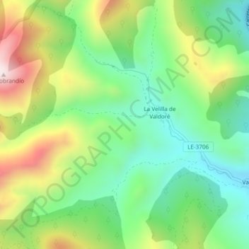
Name: Las Matas topographic map, elevation, terrain.
Location: Las Matas, Crémenes, León, Castilla y León, 24810, España (42.86647 -5.19214 42.88647 -5.17214)
Average elevation: 3,907 ft
Minimum elevation: 3,205 ft
Maximum elevation: 5,089 ft
Other topographic maps
Click on a map to view its topography, its elevation and its terrain.
Argovejo
España > Castilla y León > Crémenes > Argovejo
Argovejo, Crémenes, León, Castilla y León, 24990, España
Average elevation: 4,199 ft
La Muga
España > Castilla y León > Crémenes
La Muga, Crémenes, Montaña de Riaño, León, Castilla y León, 24990, España
Average elevation: 4,596 ft