
Nieuw- en Sint Joosland topographic map
Interactive map
Click on the map to display elevation.
About this map
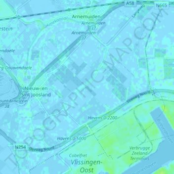
Name: Nieuw- en Sint Joosland topographic map, elevation, terrain.
Location: Nieuw- en Sint Joosland, Middelburg, Zeeland, Nederland (51.46814 3.63663 51.49795 3.70365)
Average elevation: 3 ft
Minimum elevation: -10 ft
Maximum elevation: 30 ft
Other topographic maps
Click on a map to view its topography, its elevation and its terrain.
Brigdamme
Nederland > Zeeland > Middelburg > Sint Laurens
Brigdamme, Sint Laurens, Middelburg, Zeeland, Nederland, 4333 GR, Nederland
Average elevation: 0 ft
Kanaal door Walcheren
Nederland > Zeeland > Middelburg
Kanaal door Walcheren, Middelburg, Zeeland, Nederland, 4388BV, Nederland
Average elevation: 0 ft
vliedberg
Nederland > Zeeland > Middelburg
vliedberg, Middelburg, Zeeland, Nederland, 4341NA, Nederland
Average elevation: 0 ft