
Isla Prat topographic map
Interactive map
Click on the map to display elevation.
About this map
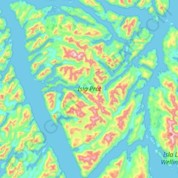
Name: Isla Prat topographic map, elevation, terrain.
Average elevation: 666 ft
Minimum elevation: -7 ft
Maximum elevation: 3,776 ft
Other topographic maps
Click on a map to view its topography, its elevation and its terrain.
Isla Little Wellington
Chile > Región Aysén del General Carlos Ibáñez del Campo > Tortel
Isla Little Wellington, Tortel, Provincia de Capitán Prat, Región Aysén del General Carlos Ibáñez del Campo, Chile
Average elevation: 686 ft
Isla Patricio Lynch
Chile > Región Aysén del General Carlos Ibáñez del Campo > Tortel
Isla Patricio Lynch, Tortel, Provincia de Capitán Prat, Región Aysén del General Carlos Ibáñez del Campo, Chile
Average elevation: 344 ft
Isla Campana
Chile > Región Aysén del General Carlos Ibáñez del Campo > Tortel
Isla Campana, Tortel, Provincia de Capitán Prat, Región Aysén del General Carlos Ibáñez del Campo, Chile
Average elevation: 509 ft