
Thank you for supporting this site ❤️
Make a donation
Make a donation
Gear up for your next adventure:
As an Amazon Associate, this site earns from qualifying purchases at no extra cost to you.
Pattemouche topographic map
Click on the map to display elevation.
Thank you for supporting this site ❤️
Make a donation
Make a donation
Gear up for your next adventure:
As an Amazon Associate, this site earns from qualifying purchases at no extra cost to you.
About this map
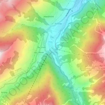
Name: Pattemouche topographic map, elevation, terrain.
Location: Pattemouche, Pragelato, Torino, Piedmont, 10058, Italy (44.96676 6.89967 45.00676 6.93967)
Average elevation: 6,273 ft
Minimum elevation: 5,016 ft
Maximum elevation: 7,831 ft
Thank you for supporting this site ❤️
Make a donation
Make a donation
Gear up for your next adventure:
As an Amazon Associate, this site earns from qualifying purchases at no extra cost to you.