
Großbottwar topographic map
Interactive map
Click on the map to display elevation.
About this map
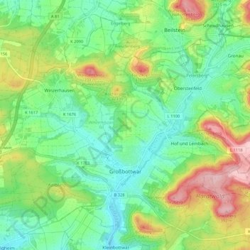
Name: Großbottwar topographic map, elevation, terrain.
Average elevation: 896 ft
Minimum elevation: 686 ft
Maximum elevation: 1,296 ft
Other topographic maps
Click on a map to view its topography, its elevation and its terrain.
Gerlingen
Duitsland > Baden-Württemberg > Landkreis Ludwigsburg > Gerlingen
Gerlingen, Landkreis Ludwigsburg, Baden-Württemberg, 70839, Duitsland
Average elevation: 1,348 ft