
Dockenfield topographic map
Interactive map
Click on the map to display elevation.
About this map
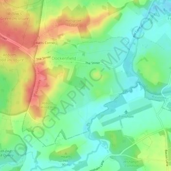
Name: Dockenfield topographic map, elevation, terrain.
Average elevation: 266 ft
Minimum elevation: 174 ft
Maximum elevation: 404 ft
Other topographic maps
Click on a map to view its topography, its elevation and its terrain.
Bramley
United Kingdom > England > Waverley
Bramley, Waverley, Surrey, South East, England, United Kingdom
Average elevation: 266 ft
Busbridge
United Kingdom > England > Waverley
Busbridge, Waverley, Surrey, South East, England, United Kingdom
Average elevation: 299 ft