
Alster topographic map
Interactive map
Click on the map to display elevation.
About this map
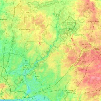
Name: Alster topographic map, elevation, terrain.
Location: Alster, Kreis Segeberg, Schleswig-Holstein, Allemagne (53.54107 9.97973 53.77776 10.15273)
Average elevation: 102 ft
Minimum elevation: -10 ft
Maximum elevation: 233 ft