
Thank you for supporting this site ❤️
Make a donation
Make a donation
Gear up for your next adventure:
As an Amazon Associate, this site earns from qualifying purchases at no extra cost to you.
Gingins topographic map
Click on the map to display elevation.
Thank you for supporting this site ❤️
Make a donation
Make a donation
Gear up for your next adventure:
As an Amazon Associate, this site earns from qualifying purchases at no extra cost to you.
About this map
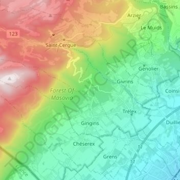
Name: Gingins topographic map, elevation, terrain.
Location: Gingins, District de Nyon, Vaud, 1276, Switzerland (46.40248 6.07458 46.44745 6.19682)
Average elevation: 2,536 ft
Minimum elevation: 1,322 ft
Maximum elevation: 5,016 ft
Thank you for supporting this site ❤️
Make a donation
Make a donation
Gear up for your next adventure:
As an Amazon Associate, this site earns from qualifying purchases at no extra cost to you.