
尼玛镇 topographic map
Interactive map
Click on the map to display elevation.
About this map
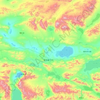
Name: 尼玛镇 topographic map, elevation, terrain.
Location: 尼玛镇, 尼玛县, 那曲市, 西藏自治区, 中国 (31.21033 86.76260 32.63272 87.98274)
Average elevation: 16,115 ft
Minimum elevation: 14,646 ft
Maximum elevation: 20,558 ft
Other topographic maps
Click on a map to view its topography, its elevation and its terrain.