
Schernberg topographic map
Interactive map
Click on the map to display elevation.
About this map
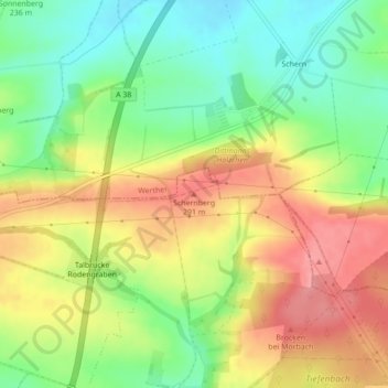
Name: Schernberg topographic map, elevation, terrain.
Average elevation: 827 ft
Minimum elevation: 673 ft
Maximum elevation: 991 ft
Other topographic maps
Click on a map to view its topography, its elevation and its terrain.
Wöbelsburg
Deutschland > Thüringen > Landkreis Nordhausen > Bleicherode
Wöbelsburg, Bleicherode, Landkreis Nordhausen, Thüringen, Deutschland
Average elevation: 1,053 ft
Friedrichsthal
Deutschland > Thüringen > Landkreis Nordhausen > Bleicherode > Friedrichsthal
Friedrichsthal, Bleicherode, Landkreis Nordhausen, Thüringen, Deutschland
Average elevation: 801 ft