
Camela Amões topographic map
Interactive map
Click on the map to display elevation.
About this map
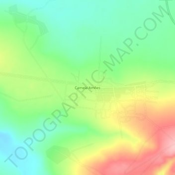
Name: Camela Amões topographic map, elevation, terrain.
Location: Camela Amões, Huambo Province, Angola (-12.40707 16.01214 -12.36707 16.05214)
Average elevation: 5,105 ft
Minimum elevation: 4,911 ft
Maximum elevation: 5,397 ft
Other topographic maps
Click on a map to view its topography, its elevation and its terrain.
Bailundo
Angola > Huambo Province > Bailundo
Bailundo, Huambo Province, Angola
Average elevation: 4,948 ft