
دهستان پاسخن topographic map
Interactive map
Click on the map to display elevation.
About this map
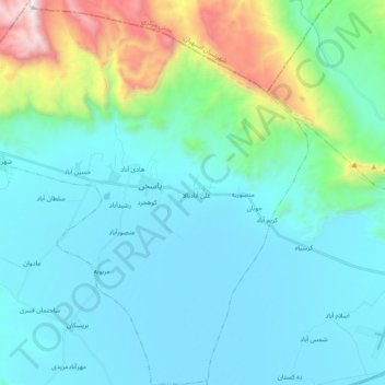
Name: دهستان پاسخن topographic map, elevation, terrain.
Location: دهستان پاسخن, بخش مرکزی, Darab County, Fars Province, Iran (28.69926 54.21723 28.87316 54.40279)
Average elevation: 4,472 ft
Minimum elevation: 3,484 ft
Maximum elevation: 9,262 ft
Other topographic maps
Click on a map to view its topography, its elevation and its terrain.
لاله
Iran > Fars Province > Darab County > Darab
لاله, Darab, بخش مرکزی, Darab County, Fars Province, Iran
Average elevation: 4,137 ft