
Lac Frédéric topographic map
Interactive map
Click on the map to display elevation.
About this map
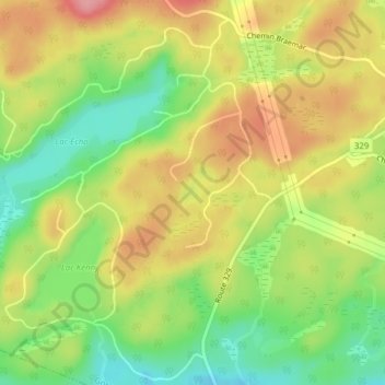
Name: Lac Frédéric topographic map, elevation, terrain.
Location: Lac Frédéric, Gore, Argenteuil, Laurentides, Québec, Canada (45.74170 -74.28392 45.74445 -74.28059)
Average elevation: 823 ft
Minimum elevation: 643 ft
Maximum elevation: 1,001 ft
Other topographic maps
Click on a map to view its topography, its elevation and its terrain.
Lac des Sucreries
Canada > Québec > Argenteuil > Gore
Lac des Sucreries, Grace Park, Gore, Argenteuil, Laurentides, Québec, Canada
Average elevation: 1,004 ft
Lakefield
Canada > Québec > Argenteuil > Gore
Lakefield, Gore, Argenteuil, Laurentides, Québec, Canada
Average elevation: 863 ft