
Mal Abrigo topographic map
Interactive map
Click on the map to display elevation.
About this map
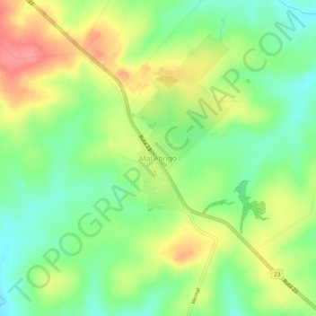
Name: Mal Abrigo topographic map, elevation, terrain.
Location: Mal Abrigo, San José, Uruguai (-34.16640 -56.97287 -34.12640 -56.93287)
Average elevation: 436 ft
Minimum elevation: 318 ft
Maximum elevation: 587 ft
Other topographic maps
Click on a map to view its topography, its elevation and its terrain.
Ciudad del Plata
Uruguai > San José > Ciudad del Plata
Ciudad del Plata, San José, 80500, Uruguai
Average elevation: 10 ft