
Tecomán topographic map
Interactive map
Click on the map to display elevation.
About this map
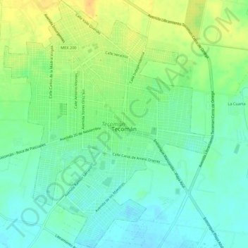
Name: Tecomán topographic map, elevation, terrain.
Location: Tecomán, Colima, México (18.88627 -103.89961 18.93741 -103.85544)
Average elevation: 121 ft
Minimum elevation: 79 ft
Maximum elevation: 180 ft
Other topographic maps
Click on a map to view its topography, its elevation and its terrain.