
Gilbert Creek topographic map
Interactive map
Click on the map to display elevation.
About this map
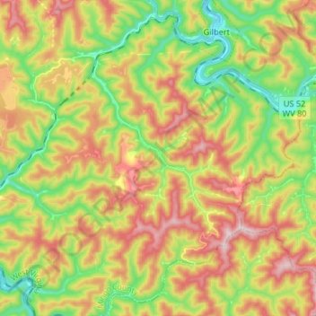
Name: Gilbert Creek topographic map, elevation, terrain.
Location: Gilbert Creek, Mingo County, West Virginia, United States (37.52438 -81.95994 37.62007 -81.82774)
Average elevation: 1,444 ft
Minimum elevation: 801 ft
Maximum elevation: 2,201 ft