
Zacualpan de Amilpas topographic map
Interactive map
Click on the map to display elevation.
About this map
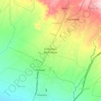
Name: Zacualpan de Amilpas topographic map, elevation, terrain.
Location: Zacualpan de Amilpas, Zacualpan, Morelos, México (18.74823 -98.80805 18.82823 -98.72805)
Average elevation: 5,374 ft
Minimum elevation: 4,862 ft
Maximum elevation: 6,201 ft
Other topographic maps
Click on a map to view its topography, its elevation and its terrain.
Tlacotepec
México > Morelos > Zacualpan > Tlacotepec
Tlacotepec, Zacualpan, Morelos, México
Average elevation: 5,791 ft