
Poço da Corga de Pena Calva topographic map
Interactive map
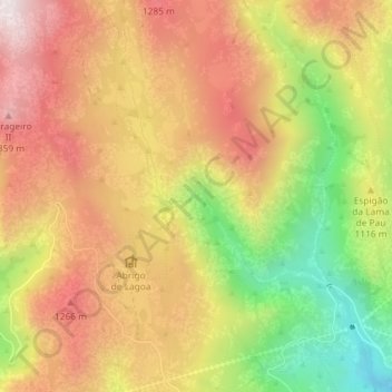
Click on the map to display elevation.
About this map
Name: Poço da Corga de Pena Calva topographic map, elevation, terrain.
Average elevation: 3,576 ft
Minimum elevation: 2,303 ft
Maximum elevation: 4,577 ft
Other topographic maps
Click on a map to view its topography, its elevation and its terrain.
Miradouro de Fafião
Portugal > Vila Real > Montalegre > Cabril > Fafião
Miradouro de Fafião, Rua da Portela do Monte, Fafião, Cabril, Montalegre, Vila Real, 4850-336, Portugal
Average elevation: 1,598 ft
Lapela
Portugal > Vila Real > Montalegre > Cabril
Lapela, Cabril, Montalegre, Vila Real, Portugal
Average elevation: 2,343 ft
Sete Lagoas
Portugal > Vila Real > Montalegre > Cabril
Sete Lagoas, Cabril, Montalegre, Vila Real, Portugal
Average elevation: 3,064 ft
Barragem do Ribeiro do Penedo
Portugal > Vila Real > Montalegre > Cabril
Barragem do Ribeiro do Penedo, Cabril, Montalegre, Vila Real, Portugal
Average elevation: 2,953 ft
Minas dos Carris
Portugal > Vila Real > Montalegre > Cabril
Minas dos Carris, Cabril, Montalegre, Vila Real, Portugal
Average elevation: 4,426 ft
Fafião
Portugal > Vila Real > Montalegre > Cabril
Fafião, Cabril, Montalegre, Vila Real, 4850-336, Portugal
Average elevation: 1,601 ft