
Municipio de Carpintería topographic map
Interactive map
Click on the map to display elevation.
About this map
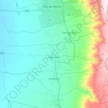
Name: Municipio de Carpintería topographic map, elevation, terrain.
Location: Municipio de Carpintería, Junín, San Luis, Argentina (-32.43350 -65.08983 -32.37841 -64.91938)
Average elevation: 3,376 ft
Minimum elevation: 2,274 ft
Maximum elevation: 7,428 ft
Other topographic maps
Click on a map to view its topography, its elevation and its terrain.