
River Goyt topographic map
Interactive map
Click on the map to display elevation.
About this map
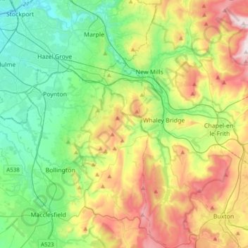
Name: River Goyt topographic map, elevation, terrain.
Average elevation: 804 ft
Minimum elevation: 135 ft
Maximum elevation: 2,080 ft
Other topographic maps
Click on a map to view its topography, its elevation and its terrain.
Macclesfield Canal
United Kingdom > England > Cheshire East > Stockport
Macclesfield Canal, Stockport, Cheshire East, Greater Manchester, England, SK10 4GX, United Kingdom
Average elevation: 627 ft