
Tarlton topographic map
Click on the map to display elevation.
Tarlton
Tarlton's elevation is 902 feet above sea level.
About this map
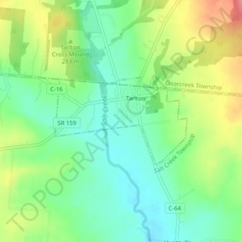
Name: Tarlton topographic map, elevation, terrain.
Location: Tarlton, Pickaway County, Ohio, 43156, United States (39.54847 -82.78769 39.55824 -82.76857)
Average elevation: 942 ft
Minimum elevation: 830 ft
Maximum elevation: 1,122 ft
Pickaway County trails, hiking, mountain biking, running and outdoor activities