
Lagfifat topographic map
Interactive map
Click on the map to display elevation.
About this map
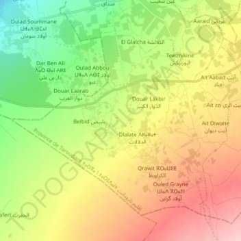
Name: Lagfifat topographic map, elevation, terrain.
Average elevation: 469 ft
Minimum elevation: 226 ft
Maximum elevation: 758 ft
Other topographic maps
Click on a map to view its topography, its elevation and its terrain.
Laksiba Oulad Said
Maroc > cercle d'Ouled Teima > Ahl Ramel
Laksiba Oulad Said, Ahl Ramel, caïdat d'Ain Chaib, cercle d'Ouled Teima, Province de Taroudant, Souss-Massa, Maroc
Average elevation: 646 ft