
河曲县 topographic map
Interactive map
Click on the map to display elevation.
About this map
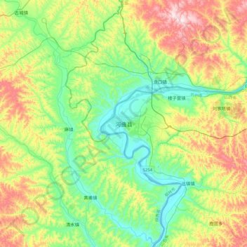
Name: 河曲县 topographic map, elevation, terrain.
Location: 河曲县, 忻州市, 山西省, 中国 (39.21928 110.98607 39.53928 111.30607)
Average elevation: 3,320 ft
Minimum elevation: 2,756 ft
Maximum elevation: 4,429 ft
Other topographic maps
Click on a map to view its topography, its elevation and its terrain.