
Thank you for supporting this site ❤️
Make a donation
Make a donation
Gear up for your next adventure:
As an Amazon Associate, this site earns from qualifying purchases at no extra cost to you.
Escorca topographic map
Click on the map to display elevation.
Thank you for supporting this site ❤️
Make a donation
Make a donation
Gear up for your next adventure:
As an Amazon Associate, this site earns from qualifying purchases at no extra cost to you.
About this map
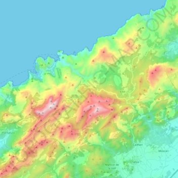
Name: Escorca topographic map, elevation, terrain.
Location: Escorca, Serra de Tramuntana, Balearic Islands, 07315, Spain (39.74721 2.72961 39.90202 2.95281)
Average elevation: 1,253 ft
Minimum elevation: -3 ft
Maximum elevation: 4,708 ft
Thank you for supporting this site ❤️
Make a donation
Make a donation
Gear up for your next adventure:
As an Amazon Associate, this site earns from qualifying purchases at no extra cost to you.