
Piana di Cannae topographic map
Interactive map
Click on the map to display elevation.
About this map
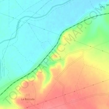
Name: Piana di Cannae topographic map, elevation, terrain.
Location: Piana di Cannae, Cardus Maximus, Barletta, BT, Apulia, Italy (41.29713 16.15109 41.29723 16.15119)
Average elevation: 121 ft
Minimum elevation: 30 ft
Maximum elevation: 253 ft