
Oberhasel topographic map
Interactive map
Click on the map to display elevation.
About this map
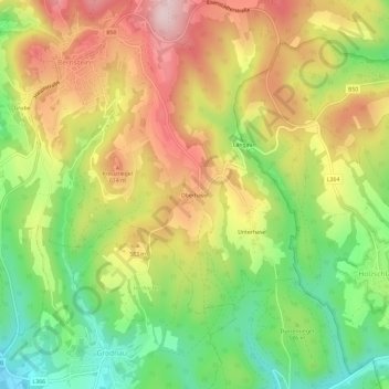
Name: Oberhasel topographic map, elevation, terrain.
Average elevation: 1,742 ft
Minimum elevation: 1,240 ft
Maximum elevation: 2,274 ft
Other topographic maps
Click on a map to view its topography, its elevation and its terrain.
Stuben
Österreich > Burgenland > Bezirk Oberwart > Gemeinde Bernstein
Stuben, Gemeinde Bernstein, Bezirk Oberwart, Burgenland, 7434, Österreich
Average elevation: 2,037 ft