
Mount Albert topographic map
Interactive map
Click on the map to display elevation.
About this map
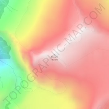
Name: Mount Albert topographic map, elevation, terrain.
Average elevation: 6,358 ft
Minimum elevation: 2,907 ft
Maximum elevation: 8,274 ft
Other topographic maps
Click on a map to view its topography, its elevation and its terrain.
Sutton Islets
Canada > British Columbia > Sunshine Coast Regional District > Area A (Egmont/Pender Harbour)
Sutton Islets, Area A (Egmont/Pender Harbour), Sunshine Coast Regional District, British Columbia, V0N 1N0, Canada
Average elevation: 1,821 ft
Madeira Park
Canada > British Columbia > Sunshine Coast Regional District > Area A (Egmont/Pender Harbour) > Madeira Park
Madeira Park, Area A (Egmont/Pender Harbour), Sunshine Coast Regional District, British Columbia, V0N 1S0, Canada
Average elevation: 318 ft